Latin America. When a news story breaks, geography becomes part of the headline. Where it happened, how it spread, which areas are affected and what may come next. However, turning that context into clear-on-air storytelling often takes too long, relies on fragmented tools, or forces teams to compromise speed, visual consistency, and operational reliability.
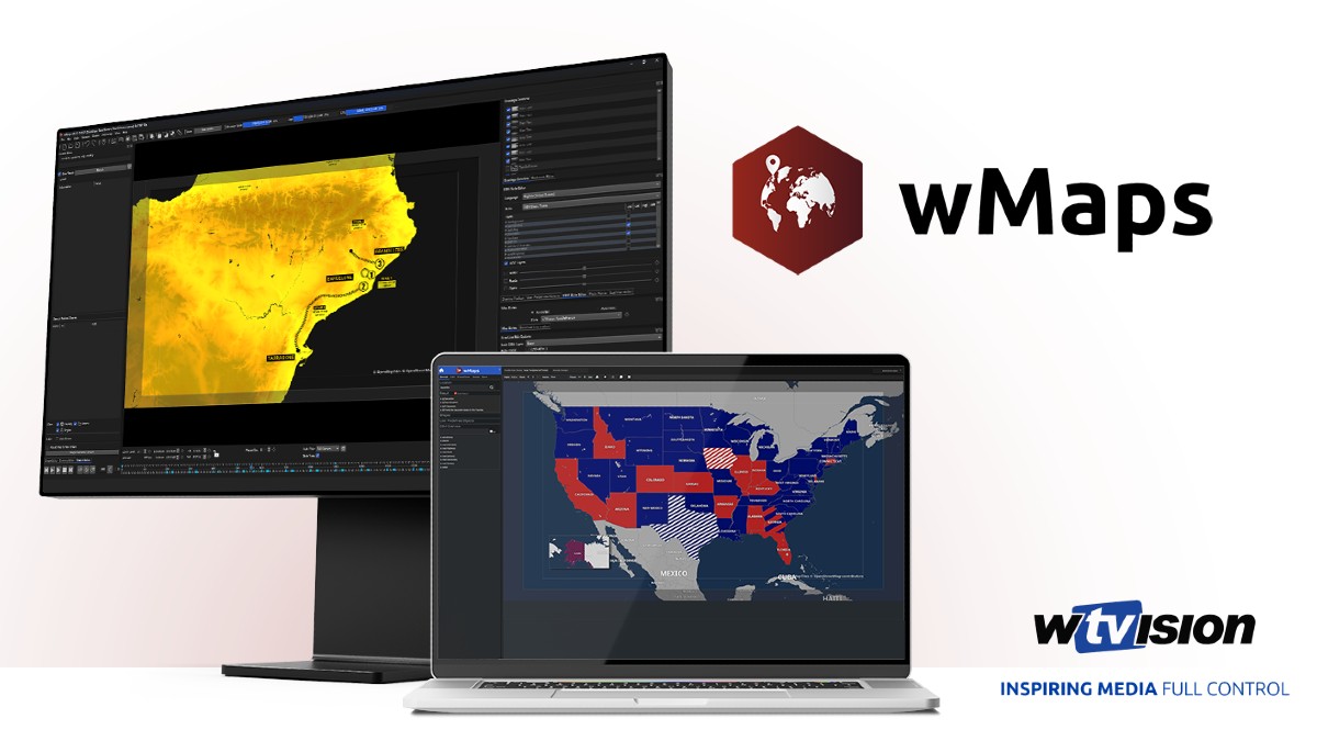
wTVision bridges that gap with wMaps, a mapping platform designed for newsroom and live production teams to bring location-based narratives to the air with clarity and rhythm. wTVision will present wMaps to the industry at NAB Show 2026 in Las Vegas, with a launch that includes two modules designed for different profiles and operational roles within the workflow: wMaps Standalone for creative teams producing advanced animations and pre-rendered outputs, and wMaps Client/Server, a browser-based newsroom environment for collaborative map production and rundown-based execution.
The Standalone module allows creative teams to design and animate 2D and 3D maps using an advanced professional graphical interface, created for high-level animation and storytelling, using Keyframes, symbols, satellite imagery and OpenStreetMap-based visuals, delivering pre-rendered outputs that integrate naturally into MAM-guided distribution and playout routines.
In parallel, the Client/Server module allows editorial teams to collaborate in real-time, through a browser-based interface, with up to 10 concurrent users per server creating and managing maps simultaneously, and supports triggering from rundown and automated playout, so that maps are part of the daily editorial rhythm and not a last-minute request.
"In our work with media companies, we consistently see the same gap: maps are key to storytelling, but they are not integrated into the workflow," said Alex Roriz, VP Global Partnerships, Business Strategy & Growth at wTVision. "wMaps brings maps directly to the production chain, completes our end-to-end Graphics & Media offering and enables editorial and newsroom teams to deliver location-based stories with broadcast standard and operational confidence."
By aligning creative production and newsroom operation under one product, wMaps helps teams build a consistent mapping language that can be repurposed across breaking news, explainers, election coverage, severe weather tracking, sports storytelling, and other location-driven scenarios, without redoing the same elements under pressure.
"In today's broadcast environment, speed and operational efficiency are critical," said Flávio Maurício, CTO of wTVision. "wMaps is a workflow-native mapping platform, fully integrated into production operations, not a standalone graphic silo. It combines real-time localization, dynamic animation, and scalable performance to support the modern execution of media and graphics workflows in newsroom environments."
wMaps integrates with wTVision's broader ecosystem of graphics and media, offering a clear operational path from map creation to playout. The result is a mapping layer that supports daily newsroom routines, maintaining the visual quality audiences expect from broadcast storytelling.